(Day 11 – August 31) The Lost Llama Lodge to Helena

Odometer: 522 – 564 (42 miles, 68 kilometers)

I woke up at 6:39 at the sound of cows mooing. The Llamas may have been making noises too but I am unfamiliar with the sound they make. It was nice of the animals to be quiet until just when I was ready to get up.

I made my way down from the loft of the small log cabin and put on some porridge.

After cleaning up and packing I was on my bike again by 8:45am. Later than I would have intended but I have no regrets given the setting.

There was a fork not far from the lodge with a sign indicating “Helena 28″ (miles). I began down the road indicated before checking my GPS which indicated the other way. Thinking that the people who had created the GDMBR knew best I followed the main GDMBR.

The day was tough. As tough as I can remember any time. I had thought foolishly that I could make Helena yesterday (August 30th). After leaving the Lost Llama Lodge I was making about 4 miles an hour.

The ascent was relentless. I walked several times and began wondering what was wrong with me. After the batteries on my mp3 ran out I began to wonder about a lot of things.”Do I need more calories?”, “Am I getting too old?”, “Do I need more water?”, “Were the only guys who rode the GDMBR superhuman?” Maybe all were true.

I have a growing respect for the people who first settled the area without electricity or fossil fuel (or mp3 players.)

I passed a deserted mine from 1880 and bumped into a fellow from Nevada on his trail bike. He might have it all figured out correctly, riding up and down the mountains, enjoying the scenery, without self propulsion.

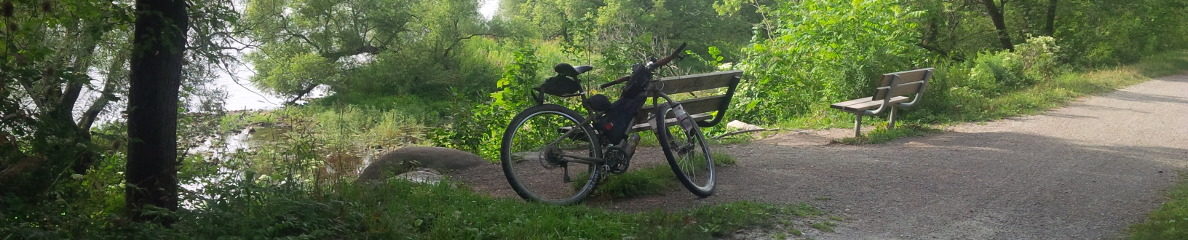
It wasn’t all up-hill; there were some descents too. But like others the roads are very rocky and rough. I braked almost all the time.

Eventually after a decent descent (from 1900 to 1400 meters) I arrived in Helena by mid-afternoon. I have decided to stay in the Holiday Inn Express where I can have a good shower and do my laundry. The contrast between last night’s quaint lodge and the Holiday Inn couldn’t be more pronounced.

I had supper at Applebee’s within walking distance and had some calories – pasta dinner, sweet potato fries, french onion soup and triple chocolate cake with ice cream. At least a calorie  deficit wouldn’t be my excuse tomorrow.


(Day 10 – August 30) The Bridge Close to Monture Creek CG to The Last Llama Lodge

Odometer: 463 – 522 ( 59 miles, 95 kilometers )

The site at the bridge by the stream was one of the best. Unfortunately Laura and Michelle weren’t here to make comparisons. I would rate it close to the top. I liked it especially because the water was easily accessible and the ground was soft and flat – great for pitching the tent.

I woke a bit before 7. Instead of aiming to have breakfast at the next town (Ovanda) I decided to make Laura’s favorite breakfast – oat meal porridge and trail mix. When I make breakfast it takes a bit longer to get on the road.   But you have to eat sometime. And besides, I have too much food. I plan to get my food down to a minimum so I can carry more water in my Platypus Water Bladder.   I’ve been told that in New Mexico you can’t have enough water. One fellow said he carries 8 litres. The last time he was travelling through New Mexico he had to give some to other cyclists who were short. My experience almost running out yesterday emphasized the need for water. Never mind New Mexico – I could be short in Montana!

When I eventually got on my bike there was a nice descent into Ovanda. I am sorry I didn’t make it the night before. The town was off the main highway but right on the GDMBR. I am guessing that the townspeople lobbied to have the town on the route to attract more business. There were numerous signs saying “Ovanda – OPEN”. Anything to direct travelers for something to eat or a night’s stay.

In spite of welcome signs, because it was morning and I’d had my breakfast and a good night’s sleep I decided to bypass the town and ride along the main highway to save time.

The GDMBR did a number of loops away from the highway. The loops were relatively short leading up into the hills and forested areas. I didn’t see the point really. I liked the speed I could get traveling along the shoulder of the highway. I had my fill of steep ascents, and for now anyway, I had my fill of the wilderness scenery.

I arrived in Lincoln about 12:30pm, had lunch and wrote a bit of my blog.   The sun was hot and I was hot. From noon ’til a little after 3pm is my least favorite time to ride.

It was about 2:30pm before I started going again. There was a bit of cloud cover, which helped, but it was still pretty hot for my liking.

The GDMBR takes a route by way of a gravel road pass through the mountains.   From Lincoln the road was easy but it became steeper and steeper. There were long stretches – perhaps about a mile or more that I gave up riding in first gear and walked. The ascent was unrelenting.

The ascent crested about 4:30pm and I began a long descent.   Unfortunately the road was very poor and I had to brake much of the way.   Some motorcycles passed me during my descent which made things even more intense.

Just as the road was beginning to improve to where I could take advantage of the energy built up in my earlier climb I got a flat tire. After giving up trying to find the leak I reluctantly put on my spare inner tube.  It took the better part of an hour to get going again.

Not long after, while still on a descent, the forested area gave way to a unique area of hills with pastures.  Because it was late and I was tired and frustrated I  stopped at The Lost Llama ‎Lodge in a gorgeous valley. Barbara, who owned the property with her husband John, belonged to the Warm Showers organization and provided everything free of charge – water, snacks, beer (yes even beer). And I didn’t have to worry about bears.

I was able to relax. I fixed my punctured inner tube and caught up on my blog while sitting on the porch of the old log cabin.


(Day 9 – August 29) Past Point Pleasant Campground to The Bridge Close to Monture Creek CG

Odometer: 383 – 463 ( 80 miles, 129 kilometers)

I woke up around 7am. I did the normal site cleanup. It always seems to take longer than I figure; stuff my night shorts and t-shirt with my sleeping pad, deflate and roll up my sleeping pad and pillow, take down and roll up the tent, take down the bear bag from a near-by tree, and load everything on the bike panniers and rollers. It all takes about an hour and I was on the bike a little past 8.

I didn’t make my porridge. Instead I hoped to find somewhere to have some breakfast down the highway. Any place will do for breakfast. There is not much you can do to wreck breakfast unless you order lots of meat.

I was lucky to find a small roadside cafe that did the trick. I was the only patron since by this time it was mid-morning.‎ I ordered a vegetarian omelet, toast, fried potatoes and three french toasts. Yum.

The GDMBR turned off the main road and I rode mostly off-road in Flathead National Forest for most of the day. There were lots of ascents and descents. A few times I walked for a break from the long hard climbs in first gear. The scenery was great. There hasn’t been much rain and the fire hazard is on high. I could tell because the streams were dried up.   I was becoming anxious as creek after creak was nothing but rocks and I needed water.

At 2:30pm after a long ascent I found a small stream running through thick moss. I finally filled my water bottles with the cold stream water and was on my way.

I arrived in the town of Seeley after a long descent, fast without a lot of rough ground. It was there I discovered I had left my water bottles by the stream.

The thought briefly crossed my mind to return to the stream to retrieve them but the ascent dissuaded me.   I resorted to finding poor replacements at the hardware store.

I had supper at a road side food joint (potato salad and pulled pork sandwich). I managed to fill my new water bottles. I debated about staying in town for the night since it was 6pm. However I am reminded daily that the evening is the most enjoyable time to ride after the afternoon heat.

So I decided to press on the next town (Ovanda or something). I turned on my lights in anticipation of night riding through what was now called Lolo National Forest and set off. About 10 miles short of Monture Campground clouds rolled in behind me accompanied with thunder and lightening.   I decided to set up my tent in the darkness just as it was starting to rain about 8:30pm.

At bedtime I also discovered I had misplaced my toque. The toque keeps my head warm when the night gets cold (needed when you don’t have a lot of hair).


(Day 8 – August 28) Whitefish Bike Retreat to Just Past Point Pleasant Campground

Odometer: 308 – 383  ( 75 miles,  121 kilometers)

I packed up and said goodbye to Laura and Michelle. I left the retreat at 10:20am and cycled along the familiar highway back to Whitefish.

After you pass through Whitefish there are paved bike trails for a short distance before the main trail follows scenic paved country roads.

South of Whitefish toward Columbia there were plains with expansive open fields and slight rolling hills interspersed with clusters of spruce and pine reminiscent of the BC interior, surrounded by distant mountains. If the mountains were removed it might look like the area around Peterborough Ontario.

The roads south of Whitefish along the GDMBR were a mix of gravel and asphalt, almost deserted and either planned in a grid or winding to make way for streams and hills.

I reached Ferndale by about 3 and chose to take the main highway because it afforded more services and stops.   I had supper, hamburger and beers, at a restaurant/bar about 4:30pm.

The restaurant was empty which worried me. It was looked after by a waitress, who was also the cook. I didn’t see whether she washed the dishes too but she seemed to be the only one there. I asked whether a lots of people stopped by. She assured me that the restaurant was full at lunch.  She told me that everything on the menu was good and I told her she was paid to say that. Then I asked about whether there were any reports of bears in the area. She said that the bears were still in the mountains eating huckleberries and I wondered if she was paid to say that too.

I was told by someone else in town that there was a nice camp spot called Point Pleasant 7.1 miles further. “Be careful,” they said. “The signs aren’t very clear.”

I got on my bike and rode 7.1 miles further. There happened to be a road with some signs but nothing saying “Point Pleasant”. After three more miles I figured I had missed it and so I stopped for the night at a deserted logging road just off the highway.


(Day 7 – August 25) The Best Bridge Over a Stream to Whitefish Bike Retreat

distance: approx. 38 miles

With sadness we left the best campsite site since starting the trip and set off along the trail.   The trail ascended for 3 miles before we reached Red Meadow Campground. The campground was situated beside a small lake in a clearing. Although it was picturesque we all felt confidently that The Best Bridge Over a Stream was better.‎

The gravel road continued through wilderness until just after lunch we hit asphalt justt as we approached Whitefish Lake.  The pavement was a welcome break from two days of bumping and jarring along the rough gravel. As we settled into a good pace we missed Cricket’s instructions to turn on the bicycle trails running west of the lake.

We had arrived in Whitefish before I discovered my error; too late to turn back.  Instead we were forced to follow highway 93 north west on the west side of the lake to the retreat.

We arrived at the Whitefish Bike Retreat a little after 3.   After we set up our tents we picked up our van and drove to town for a good big supper.

We spent August 27 and 28 at the retreat taking it easy, visiting Whitefish and riding the single track trails.   I found out that technical single tracks aren’t fun on a fully loaded bicycle.


(Day 6 – August 24) Grave Creek Campground to The Best Bridge Over a Stream

distance: approx 42 miles

The road through the national forest was very rough and steep in parts. In spite of this we made pretty good time. I think we’re finally adapting to biking everyday.

The girls generally rode ahead since I do not appreciate fast descents over pot-holes, rocks and washboard. I will have to check brakes for wear soon. In all my travels across Canada I seldom if ever used my brakes on descents. In contrast, on the rough GDMBR roads I have my brakes on almost all the time.

I am guessing that my reaction time and balance is not quite as good. Besides the bumps give me a headache.

Besides a few trailers and remote cabins the road led through deserted wilderness. In spite of this the signage and was very good – a pattern I have seen before in the well maintained forests.

Just after our lunch break we met 7 or 8 men, and two pastors, renting a forestry cabin for a fishing retreat. A friendly man named Tom introduced himself and explained they were from a Baptist Church in Memphis who had linked up with another church from the same denomination from Kalispel to spend some “quality” time away from their wives killing trout. They generously invited us to have some grilled chicken/ham and cheese sandwiches, cake and cookies. As they said grace for the food they extended a kind prayer for our safe travel – for which I am grateful.

I am not sure they knew how much people who biked all day could eat. Otherwise they may have been more reserved. Laura and Michelle had three sandwiches and soon all the food was gone when another group arrived to find the bowls empty. We left the pastors to explain things, thanked them profusely and took our leave.

I had planned to stay at Red Meadows Campground which was marked on the main GDMBR track. We were about 3 miles shy of Red Meadows when we saw a perfect stream by the bridge and stopped there for the night.


(Day 5 – August 23) Fernie Mountain Provincial Park to Grave Creek Campground (almost)

distance: approx 55 miles

We were out of our breakfast oatmeal so in the morning we decided to backtrack into Fernie and enjoy breakfast at a restaurant. Although I have learned to be wary of wayside lunches and dinners there is almost no way to destroy a breakfast.

So we stopped at a Smitty’s, Husky Oils restaurant counterpart. I ordered french toast (of course!). It was covered in whipped cream and blackberries. Yum. Laura and Michelle ordered some other “breakfasty” thing. I didn’t notice enviously.

By my reckoning after traveling a number of days over rough roads we needed to make up some time. I decided to to take the Great Divide MBR alternative route (the Fernie Alternative) which followed the highway with a generous shoulder through Elkford, Sparwood, Elkor, Roosville (at the U.S. border) to Eureka,MT.

We made good time.

We passed through the border without mishap. The border guard asked about oranges this time. Since we had eaten all the oranges by then we could answer honestly that we had none. My rice remained safe – he didn’t ask about rice and I didn’t volunteer.

As it turns out we all preferred to camp “primitively” – without service camping. After some discussion we had decided to camp off the main highway as the GDMBR looped into the wilderness north of Whitefish Lake.

We aimed for a small campground called Grave Creek Campground off the main trail in the national forest. Since it was late in the day and the road was unnecessarily hilly we found instead a quiet spot across the creek beside what looked like a millrace to set up our tents.

Besides the muffled noise from the campsites across the stream the site was secluded and ideal for the day.


(Day 4 – August 22) The Bridge Over a Stream to Fernie Mountain Provincial Park

After a rather windy night we had breakfast and began riding again. The weather had become cooler with overcast skies.

We started travelling on pavement again by the afternoon and approached Fernie by mid afternoon and had an early supper at Boston Pizza.

One friendly guy flagged us down in his pickup truck. We chatted about biking stories. He explained he was going on a bikepacking trip in New Mexico in October and was interested in my “planned” destination. Because he lived not far from Fernie he recommended that we alter our plans and stay at the Fernie Mountain Provincial Park at the south end of Fernie.

So  we did. The park was full but the park ranger made us feel quite welcome at the overflow camp sites (which was fine with us).   He also explained a tip of storing our food at the back of the bear proof garbage bins. (Maybe everyone out here knows about this trick.). It put my mind at ease knowing at least my campsite would be clear of food in the bear infested provincial parks.

We took advantage of the showers and hit the hay after another day.

(Day 3 – August 21) Lower Lakes Campground to The Bridge Over a Stream

distance: approx. 25 miles

It was refreshing to be out of the park by 7am and onto the wilderness gravel road.   We all seemed more anxious about animals both large (like bears) and small (like pesty raccoons) in the provincial parks. And as nice as the picnic tables and outhouses are, the noises of campers at night work on our imagination.

Once we were away from he campground the short asphalt stretches gave way to the familiar gravel, once again rough and mostly deserted.

We stopped for lunch around noon in the cool shade to eat trail mix, granola bars and what was left of the oranges.

The day turned out to be hot without much cloud cover.   By mid afternoon we started looking for a stream for some water and perhaps an opportunity to wade.   At about 3pm when the day was at its hottest we found a suitable spot by a bridge over a stream.

The stream was very cold which is not surprising.  It was a welcome relief from the dry heat of the day but wading was difficult in the numbing cold water.

We set up our tents and made supper without haste and called it a day. Up ’til now this was the best spot to camp.


(Day 2 – August 20) Spray Lake to Lower Lake Campground (Peter Lougheed Provincial Park)

distance: 38 miles

We were up fairly early – we hadn’t adapted to mountain time yet. We had breakfast of oatmeal porridge and mixed nuts, packed up the tents and were on our way.

We traveled in wilderness areas without any stores or stops for the whole day. The paths/roads were all dirt or gravel. Many of them were quite rough as I recall.

We hadn’t yet become accustomed to riding our heavily loaded bikes up the steep ascents. Michelle began to doubt whether she had made the right decision. I insisted that it would get easier as our bodies adapted but this was small comfort. Laura however, who had prepared by biking to work seemed to have little trouble on the steep hills. I had trouble keeping up.

The long winding descents were not a problem which Laura and Michelle took much faster than me.

The gravel roads improved marginally when we entered Peter Lougheed Provincial Park. We stopped at a camp office to get some idea of our bearings and site availability and ended up staying the night at the Lower Lakes Campground with running water.